Cozy

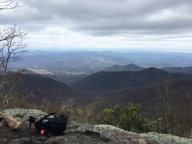
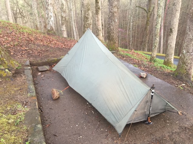
Lightning has been dancing across the sky for about an hour now. I’m on the edge of Fontana Lake, pitched on one of the concrete tent pads. The shelter here is called the “Hilton” and in 2016 I bypassed it completely. Noro virus was rampant then, and a few friends and I split a room at the Lodge for a mere $20 per person. This time around, I started to setup inside the Hilton, until I saw the sign for tenting.

Putting a Tarptent Protrail up on a concrete pad is no easy task. It’s certainly more “tarp” than “tent,” so I had to get creative. Non-free standing tents like this rely heavily on stakes, and thus a concrete slab is a real obstacle. Thankfully I got the rear of the tent staked into the ground, and some previous hikers left some large rocks to anchor the front to. I butchered the remnants of my bear bag line, and made it work.

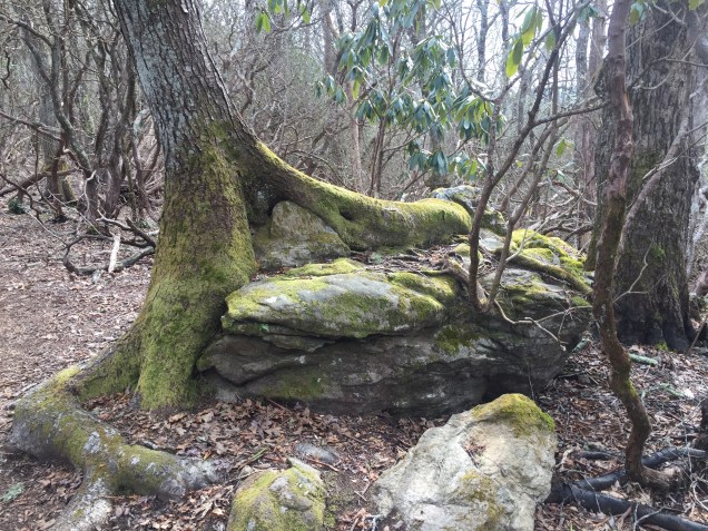
My intro to backpacking was with a 10’x10’ nylon tarp. It was the cheapest lightweight shelter I could find, and it forced me to brush up on my knots. My intro to cycling was similar, and my first two road bikes were literally pulled from the trash. Cheap entry to any activity comes with a learning curve, but the knowledge you gain that way is more valuable in the end.

Another factor with these concrete slabs, is that the rain just bounces off of them. I’ve had many drops come bouncing in, but it’s a warm night, thankfully.

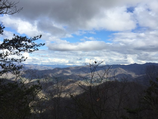
Due to weather, many hikers in the shelter are taking a zero tomorrow. I’ve decided to head out though. Tomorrow I’ll head up to Fontana Village to purchase a thru-hiker permit for the Smokies, and grab my resupply box. My sister was kind enough to mail it out for me, and she included my winter mitts. It’s warm now, but tomorrow I’ll be two or three thousand feet higher, in one of the least predictable environments in the South East.

Two years ago I went into the Smokies for an overnight. I was packed in a fashion ultralight (UL) hikers call “stupid light.” It was mid-July and in the high 80’s when we left the car. Three hours later it was 57F, pouring down rain, with gusts up to 25mph. With food and water my overnight load was 11lbs. It was Summer, so I ditched my stove, my rain jacket, and my puffy. All things I had done for months on the AT the year previous. The months I wasn’t in the Smokies…

Within two hours I began to go hypothermic. I could tell, because touching my thumb and pinky together was nearly impossible. This is an early warning sign I learned from Cody Lundin in his book 98.6 The Art of Keeping Your Ass Alive. Thanks to that book, I ran the next seven miles to the shelter, and kept my ass alive. I ate four ounces of cheese, stripped and put on my base layers, then crawled into my 55 degree bag. I slept for twelve hours.

As my friend Myra taught me early on. When it comes cold, wet, and wind, you can survive any of the two, but never all three at once. As I teach people now, bring a rain jacket! Frogg Toggs is all you need, and it’s the lightest and cheapest there is. Also, respect the Smokies!

On this trip though, my main concern is my decreased mileage per day due to my legs. This means I’ll need to carry more food, probably close to a week’s worth. That’s around fourteen pounds total. Among my errands tomorrow is checking the total mileage of the section, and planning my food around ten miles per day. Worst case scenario, I’ll resupply in Gatlinburg.

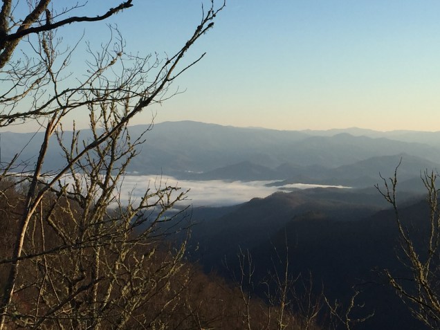
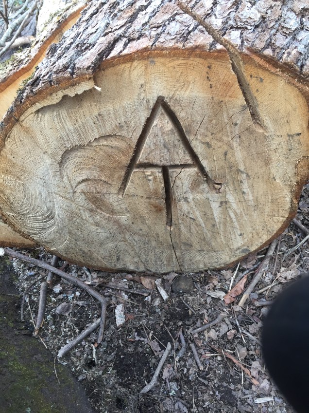
The Smokies are somewhat unique in that they require a permit, have poor resupply access, and demand all hikers sleep in the shelters no matter what. Tenting is permitted only when shelters are full, and full means your neighbor hiker is breathing on you.

What do I really dread about the Smokies? It’s not the gigantic pack-stealing bears, the weather, or the big food carry. It’s the fucking shelters, and being turned into a sardine for a week. All AT NOBOs must go through this though.

So I’ll enjoy the privacy of my tent for one more evening. This beautiful nylon roof under which I can write, snore, and get up to pee without bothering my neighbors. Shits about to get cozy.

Friends Who Mend

Today marks my second week on trail. I’m sleeping near Brown Fork Gap Shelter, mile 152.7 per the 2018 guidebook. I’ve barely made mileage during the past week. Shortly before Franklin I began experiencing shin splints in my left leg. I took a “nero” day into Franklin, hiking only eight miles, and then a full zero day after. Mud Turkey quickly left me behind after the town shuttle dropped us off at Rock Gap.

In town I babied my leg. I iced it, elevated it, took ibuprofen, and ate really healthy foods. The pain leaving Rock Gap was really bad, and I almost caught the shuttle back into Franklin at Winding Stair Gap, just five miles away. I calculated my pace at 1.75 miles per hour, and decided it was good enough to continue. By seven in the evening, I hobbled out fifteen miles.

The next day I experienced a lot of swelling, which I noticed while eating lunch on top of Rocky Bald. The view here was epic, and being a quarter mile side trail, I had it to myself.

The view from Rocky Bald

When I made it down to Tellico Gap later that day, my leg was still swollen and in a lot of pain. A physical trainer named Jeff just happened to be there (the trail provides) so he examined it. He thought it might be a stress fracture, MTSS (shin splints), or Compartment Syndrome. I called my sister, because she is a massage therapist, and I reached out to Some Shine, who has had a similar injury.

My sister and I went through various diagnostics, and everything pointed back to medial tibial stress syndrome (MTSS). Some Shine advised me to listen to my body, and use my intuition.

I decided to take another zero, and Some Shine was kind enough to spend it with me. The following day, I hitched out of the NOC some fifty miles into Murphy. She picked me up, and then her and I went back to Franklin for cheap lodging. She drove all the way up from Fayetteville!

We spent two days there, and it was so nice to hang out with her. I kept my

leg up most of the time, but we did get out and walk short distances. We ate great food, watched the new Spider-Man movie, and fell asleep in each other’s arms each night. It was wonderful.

Friday her and I got up and drove to the NOC. We did a quick gear shakedown in the parking lot. Then she donned her Exos 58, and we headed up the mountain. We found a pretty nice little campsite about seven miles in, and set up.

She was quite amused by my elaborate sleeping system, and simply spread out her torso-length foam pad onto the floor of the tent. We ate a simple Mac and cheese dinner. I managed to loose my bear bag line, and my rock sack in a 20ft tree branch after dinner. This of course, after I told her how awesome I was at throwing bear lines…

The next morning we took our time getting up and eating breakfast. We headed up to Sassafras Gap Shelter for water, and ran into Pippy and Salamander. Salamander taught us a few flowers, among them Spring Beauties and Trailing Arbutus.

Trailing Arbutus

She’s an ecologist who loves, you guessed it, salamanders! Pippy is named for the long-stocking hat she often wears. Librarian is the third member of their group, and those girls are by far the most fun people I’ve met on trail so far.

Some Shine and I walked from the shelter back to the trail and said our goodbyes. I held her for a long time, kissed her forehead, and the time came. She headed south, back to the NOC, and I headed north again. She’s been having a rough time in life lately, which made it more difficult to say goodbye. It also made her choice to come up that much more precious to me.

She is simultaneously the person I most want to leave trail to spend time with, and the only one I trusted to keep me on trail during this time. I had many insecurities during those three days, and she helped me navigate them. She’s one of the kindest and most giving people I know.

I ate lunch on Cheoah Bald, and found Librarian there with Pippy and Salamander. The view was amazing. That is when I decided to make for Brown Fork Gap Shelter, bringing the day to about ten miles.

Cheoah Bald

Photos From Wesser Bald Area

I had a random dusting of snow yesterday. I shot a nice panoramic view from the tower at Wesser Bald. I’ll upload it when I find WiFi again.

I left camp early and warmed up slowly. My left leg is still swollen, but it’s not worse, and the swelling hasn’t moved at all.

Today has been a lot of fun ridge running and twisty winding staircase trail.

I’ve stowed my trekking poles in my back. Often I over exert my steps when I use them. I’m hoping that hiking a short day without them will help correct whatever is causing my leg issue.

Today is beautiful and warm!

Silver Alert

Age demographics on trail are a funny thing, and tonight I’m sleeping at what I’ll call “Geezer Camp.” Mud Turkey and I are sharing one of the sites within Betty Creek Gap, and we’re the youngest men here by at least thirty years. While I was putting the finishing touches on what has to be the best bear bag hang of my life, I heard a strange sound in the distance.

Master-level bear hang. OP Sak, using PCT method

“HELP! HEEEEELLLPPPP!!”

The words repeated at slow and steady intervals, and a man named Joe asked me if I heard it. I had my puffy jacket and my headlamp on, so I ran up trail towards the sound. Soon the situation was obvious. I stood before the sign marked “toilet area” which, was actually just a maze of rhododendron trees. One of the gray haired voyagers had lost their way, probably after their evening constitutional.

“ARE YOU INJURED?” I shouted back. The reply was negative, and a most serious game of Marco Polo began. Soon, I saw bushes waving back and forth, and briefly my irrational fear of Jurassic Park Velociraptors perked. To my relief however, a tall man dressed in khaki colored clothes emerged, orange trowel in hand. Joe and I had been talking and laughing quietly to ourselves this whole time.

“You fellas may have just saved an old man’s life!” The stranger bellowed.

He was visibly shaken and quite embarrassed, so I resisted the urge to give him a (new) trail name. On the way back to camp I told him about Wrong Way, who did something similar. As I understand it, she stopped off the Approach Trail to pee, got turned around, and walked all the way back to the arch at Amicalola. That was in 2016, and she did indeed make it Katahdin. The story gave him a laugh and he seemed in good spirits when we reached his tent.

I went back to my spot to tell Mud Turkey all about it. As it turns out, he was the headlamp I saw in the distance last night. I met Mud Turkey at Blue Mountain Shelter, and we have a similar hiking style and temperament. Tomorrow he and I plan to hike the twelve miles to Winding Stair Gap, and shuttle into Franklin. We’re going to split a hotel room, which will make for my first shower in seven days. My armpits smell like rotting peppercorns!

Lots of burned out rhododendron.

I think he’ll take a zero there, and I might too. My crunchy left ankle has now festered into what I fear may be shinsplints. All I can do really is ice it, and keep moving. Mud Turkey’s pinky toes are being blistered by his Salomon boots, but thankfully Franklin is home to Outdoor 76. They are probably the most knowledgeable hiking shoe fitters in the South East.

My gear is all performing quite well. My new Hyperlite pack is wonderful, and each day I pack it a tiny bit differently. I think I’ve almost got it dialed in. Phone and .Mp3 player go in the right hipbelt pocket, along with a few guidebook pages. In the left I keep a lighter, my headlamp, a spare battery, sunscreen and hand sanitizer. These large pockets are a massive improvement over my last pack. Being able to get to things quickly and conveniently while walking is priority one.

Hikers are lazy, and I am a hiker. If I can’t reach my water without taking my pack off, I’ll put off drinking it. The same goes with sunscreen, and sanitizer. I rolled about five feet of Leuko tape onto my trekking pole, so I can stop and address blisters pack-on, without having to rummage.

After Franklin the next big stop will be Fontana, shortly before entering the Smoky Mountains. I’m about 68 miles miles away.

Cleared Georgia

It’s warm tonight. My hope is that I’ll be able to get up and eat a hot breakfast before leaving camp in the morning. It’s been too cold to do that lately, and there are two options for dealing with that.

The first is to sleep in till 10am or so, when the sun is high and it’s often ten to twenty degrees warmer. Option two is my preferred way of dealing with cold mornings. In this method you wake at dawn, pack as quickly as possible, shove a cliff bar in your mouth and start hiking as fast as you can.

If you’re lucky, it’s above freezing and you don’t even have to stop for water, because you have two or three liters filtered and ready to go. For nights where it does freeze, or I suspect it will, I’ll filter one liter to drink overnight, and gather the rest in the morning. For me cold mornings mean numb hands, and the only way to un-numb them is to make miles. Fast. As long as you eat first!

Google “Navy Seal Dynamic Warmup Drill” and read thoroughly. The static drill is worth knowing too.

I went over Blood Mountain the morning after my last post. I had a quiet lunch at the overlook with two day hikers who were very interested in what I was doing. As I headed down the back side of the mountain, I could see rain clouds rolling in. I made an extremely fast resupply stop at Neel’s Gap, after I realized I was a half day short on food. I raided their hiker box before entering the store (I’m not a rookie anymore) and scored nearly a full bag of Triscuts. Olive oil packets, Crystal Light packets, and a lone peppermint patty also dropped into my food bag. Always check the hiker box!

After leaving the gap I decided to gamble and head to Whitley Gap Shelter. Most AT shelters are within .2 miles of trail, but Whitley is 1.2 miles off trail. The storm was coming, and most of my fellow thru hikers do not have their legs yet. The bet paid off, I was the fourth hiker to roll in, thus securing both a dry place to sleep, and forgoing packing a wet tent in 30 degree wet misty morning. Come the storm did. Hikers at Neel’s Gap reported hail, and I bet we had some too.

The next morning I went to Low Gap Shelter, which I’d wager a large sum was full to the brim during hail night. A section hiker was kind enough to supply my toilet paper (okay, maybe I am still a rookie) and thus had my thanks. That night and Blue Mountain Shelter, I gave him my shelter spot, and I tented in the rain. It was a cold morning, but I made some coffee anyway. It tasted lovely!

At Blue Mountain I met Clammy, a hiker who is finishing his Triple Crown. He just got off of the CDT last year. Brian, a fellow AOC member was there, and from what I understand, we now have four Atlanta Outdoor Club members thru-hiking the AT this year.

This morning I hiked out of Deep Gap Shelter, and into Top of Georgia Hostel. I spoke with the owner, Bob, who recognized me, as I’ve rolled through there a few times now. We talked about life, divorce, and how things always happen for a reason. I picked up my resupply box, and ate a pizza, while speaking with a young Chinese college student. Apparently he was on a group section hike, and couldn’t keep up. I encouraged him to try it again someday.

I met a hiker named Slip and Slide, while trying to gauge the distance to the next shelter. She was using the Gut Hook App, but I prefer the AWOL Guide, and I prefer a paper copy over the .pdf. We figured it out, and she asked me to camp at Bly Gap so she wouldn’t be there alone. I crossed the GA/NC border at 5pm, on day six. That’s 86.4 miles with the Approach trail included.

I met Slip and Slide and Bly Gap, and there were already nine tents pitched. The climb out of Bly Gap sucked every bit as much as it did last time. I decided to press on to Muskrat Creek Shelter, about two miles out.

I could hear the people and the guitar a long ways off, and ducked off trail to check it out. I was greeted by a good looking girl in large glasses with a hammock setup. She told me there might be space behind the shelter. We chatted for a few, and I decided to press on to White Oak Stamp, about another .8 down trail.

Bly Gap was too exposed and windy, Muskrat was too loud and crowded, but White Oak Stamp is sheltered, cozy, and quiet. I have one neighbor, and I only know, because their headlamp pops up now and again in the distance. It’s nice to camp alone. I just stepped out to pee, and the stars are magnificent here. I boiled up some mac and cheese for dinner, and in the absence of tea, made a propel packet with hot water. I think the salt intake before bed is wise.

My body feels great. Except for one night, where my legs ended up down hill, and they locked up. Water and vitamin I. My back aches and my ankles are a little crunchy. I ran down a couple miles of mountain side yesterday, which I live for, but my knees asked me to wait a little while before I do that again.

I’m snuggled up tight under a small grove of rhododendron, and I saw my first patch of “you can do it!” flowers this afternoon. Oh, and here are my gaiters in all their glory. When they sparkle in the sun, it makes me and passers by very happy! Take care friends!

On Trail!

I’m currently sleeping in an unnamed gap, about a mile south of Lance Creek on the AT. Trail mile 22.6(ish). Today was a 14.5, yesterday I did a bit over 16.5 miles with the Approach Trail included. There is a ten mile section to the north, which requires hikers to carry bear canisters for overnight stays. Many hikers will edge up to the boundary, then hike across in the morning, making the camping at Lance Creek prime real estate. I stayed there in 2016, but to get a spot I had to roll in just after noon.

Rather than fuss with the crowd, I chose this gap, which has level ground enough for me and a potential neighbor.

I hung my bear bag using the PCT method per the advice of (Master) Splinter, a Ridge Runner who was teaching LNT methods to new hikers at Amicalol Falls. The Ridge Runners are employed by the Appalachian Trail Conservancy primarily as educators. They teach leave no trace to hikers, to limit damage to the trail. They are also veritable encyclopedias on their patrol route.

Gus once told me the exact spot where my phone would have service, three miles from where I met him. No bars, no bars, BAM! Three! He was spot on. Fifty feet to the left of Gooch Gap Shelter.

It was thanks to another Ridge Runner, Captain Planet, that I had some intel about the state of the crowd at Lance Creek today. She advised me to steer clear and aim for my present position. She loved my pink sparkly gaiters, and took a picture for her collection of things that make her happy. Don’t worry friends, you’ll see them in sunlit high resolution glory as well soon enough!

John sent me a picture of the snow he is dealing with in the Smokys right now. It’s hard to believe I’ll be up there in a couple of weeks. His hike seems to be going very well, though alas, no trail name yet. It’ll come in time, and I’m sure it will be quite epic!

He’s gotten plenty of trail magic so far, and with the weather he’s been through, I’m glad! A former thru hiker lady in her late 60’s gave me an interesting piece of trail magic. She pulled out a deck of cards, spread it out horizontally and asked me to take one “for luck.” I pulled this from the spread:

Good tidings indeed!

Tomorrow I’m going to try to hike all the way to Low Gap Shelter. It’s 20 miles away, and full of good memories. I have a small grocery list for the store at Neel’s Gap tomorrow, mainly more stove fuel and sunscreen. I took about two ounces of both, and it was quite an oversight. The sun is strong right now, and leafless trees offer no refuge. It’s not quite Spring in the mountains just yet. I did see a few violets, and this flower, which I do not know, but it reminds me of my mother.

At Neel’s I’ll be purchasing a few more snack items, maybe an extra dinner too. My first resupply box is 78 miles in (including the Approach Trail). I rolled out with a little over four days worth of food, and I think I’m going to run short.

I’m so happy to be back out here though. Happy to sleep in my posh “tiny house” again.

Every ounce of anxiety I had before trail disappeared when we pulled up to Amicalola Falls. I pretty much bounced and skipped my way to the arch.

And… The rain just started a day early. Take care friends!